Saturday, 12 January 2013

Wednesday, 9 January 2013
Tuesday, 8 January 2013
[4ºESO] Flatland. Libro de lectura de matemáticas
El libro de lectura de la asignatura de matemáticas de este curso será
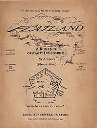
Es un libro que podéis encontrar en internet para descargar de manera gratuita.
También dejaré algún ejemplar en la biblioteca, por si preferís sacarlo.
Por ejemplo, en estos enlaces está en
formato epub.
formato pdf.
audiobook. (Grabaciones de los capítulos del libro, realizada por hablantes nativos). El archivo .zip con la grabación en .mp3 está en este enlace.
"Flatland" de Edwin A. Abbott.
Es un libro que podéis encontrar en internet para descargar de manera gratuita.
También dejaré algún ejemplar en la biblioteca, por si preferís sacarlo.
Por ejemplo, en estos enlaces está en
formato epub.
formato pdf.
audiobook. (Grabaciones de los capítulos del libro, realizada por hablantes nativos). El archivo .zip con la grabación en .mp3 está en este enlace.
Sunday, 23 December 2012
The Man in the Iron Mask
In the last adventure of the three muskeers, Aramis wants to change king Louis XIV and Philippe, his twin brother. Read "The Man in the Iron Mask" if you want to know if Aramis gets it.

Monday, 3 December 2012
A Kiss Before Dying
I liked this book because is very easy to understand and the vocabulary is not difficult.I will recommend the book,you will read it very quickly because there are not a lot of characters and the story is very simple.
Sunday, 2 December 2012
4ºESO. Unit 3 Trial Exam with worked out solutions
Aquí os dejo el examen de prueba con las soluciones "worked out" (cómo se hacen, paso a paso).
Friday, 23 November 2012
SOCIAL SCIENCES Introductory Unit (page 4 the last) Introductory Unit
INTRODUCTORY UNIT: GEOGRAPHY AS A
SCIENCE. MAPS AS THE MAIN TOOL IN GEOGRAPHY.
SUMMARY
PAGE 4
9. MAPS TODAY. COMPUTING OR DIGITAL
MAPPING:
G.I.S. stands for GEOGRAPHIC
INFORMATION SYSTEMS
DEFINITION: any
information system that captures, manages, analizes and displays
all forms of geographically referenced information.
MAIN APPLICATIONS:
- Resource management
- Environmental impact assessment
- Urban planning
- Logistics
Etc.
G.P.S. stands for GLOBAL POSITIONING
SYSTEM
DEFINITION: global
navigation satellite system which provides reliable positioning,
navigation and timing services to worldwide users on a continuous
basis.
MAIN APPLICATIONS:
- Calculate and programme routes for
planes, ships, cars and people.
REMOTE SENSING
DEFINITION:
science or technique of
acquiring information about the Earth's surface without being in
contact with it.
SCIENTIFIC
BASIS: all bodies
emitte or reflect electromagnetic energy sensed and recorded in
digital format by sensors installed on satellites.
MAIN
APPLICATIONS:
-
Weather
forecast
-
Coastal management
-
Crop control
-
Evaluate damages of natural disasters
Etc.
10.
WORKING WITH MAPS:
PROBLEMS
WITH SCALE
Example:
- map scale 1: 20,000,000
- real distance between London and Rome?
*
Measure with a ruler the distance on the map: 8 cm.
*
Multiply the distance measured on the map by the scale denominator:
10 cm x 20,000,000=100,000,000 cm.
*
Change cm to km: 100,000,000 cm : 1000 km.
SOCIAL SCIENCES Introductory Unit (Page 3)
INTRODUCTORY UNIT: GEOGRAPHY AS A
SCIENCE. MAPS AS THE MAIN TOOL IN GEOGRAPHY.
SUMMARY
PAGE 3
6. ELEMENTS OF A MAP:
The most important ones are:
- TITTLE
- SCALE
- KEY
Other elements:
- ARROW POINTING NORTH
- PROJECTION
- GEOGRAPHICAL COORDINATES (PARALLELS
& MERIDIANS)
7. TYPES OF MAP (classification):
a) According to the information
provided:
- TOPOGRAPHIC: they represent all
visible and some non-visible aspects of the land.
- THEMATIC: they represent specific
themes or issues.
b) According to the scale:
- SMALL SCALE MAPS: more than 1:
500,000
- MEDIUM SCALE MAPS: between 1:
500,000 and 1: 50,000
- LARGE SCALE MAPS: between 1: 50,000
and 1: 5,000
- VERY LARGE SCALE MAPS OR CITY
PLANS: less than 1: 5,000
8. LOCALIZATION ON A MAP:
TYPE
RELATIVE
ABSOLUTE
TECHNIQUE USED
FOR
RELATIVE LOCALIZATION
- Clues to know
the aprox. location of a place
- Point of the
compass
FOR
ABSOLUTE LOCALIZATION
- Geographical
coordinates
ELEMENTS
RELATIVE
LOCALIZATION
- Near, at the
back of, opposite to, etc.
- N, S, E and W
ABSOLUTE LOCALIZATION
Parallels
(LATITUDE 0-90º
N or S) and Meridians (LONGITUDE 0-180º
E or W).
SOCIAL SCIENCES 3 Introductory Unit (pages 1, 2)
INTRODUCTORY
UNIT: GEOGRAPHY AS A SCIENCE. MAPS AS THE MAIN TOOL IN GEOGRAPHY.
SUMMARY
PAGE 1
- DEFINITION:
Science dealing with the study of the
distribution of any phenomena in the Earth's surface, as well
as the interaction of human beings with the environment.
- NATURAL SCIENCES deal with the study of nature, whereas SOCIAL SCIENCES deal with the study of societies and human activities.
PHYSICAL GEOGRAPHY focuses on
geography as an Earth Science and therefore a natural science.
It is concerned with the physical characteristics and processes of
the lithosphere, hidrosphere, atmosphere and biosphere.
HUMAN GEOGRAPHY focuses on geography
as a social science. It is concerned mainly with human
activities, overall those related to the interaction of humans with
the environment.
- APPROACHES TO GEOGRAPHICAL STUDIES:
SYSTEMATIC (GENERAL) GEOGRAPHY is
concerned with the formulation of general laws and principles
applied to all the Earth, e.g. the study of erosion processes.
REGIONAL GEOGRAPHY analyses regions
in order to understand or define their unique characteristics, e.g.
the study of the Extremadura peneplain (penillanura).
PAGE 2
- DEFINITION (map):
A flat representation of the Earth's
surface made at scale.
- MAKING MAPS:
PROBLEMS:
- The Earth is a sphere (a non-developable surface), so it cannot be represented in a plane.
- The Earth is too large to be represented in a map.
- The Earth's surface has 3D, while a map is 2D.
- The Earth' s surface is complex with a huge amount of info to represent in a small map.
SOLUTIONS:
- CARTOGRAPHIC PROJECTIONS.
- SCALE.
- CONTOUR LINES.
- CARTOGRAPHIC GENERALIZATION (USE OF SYMBOLS).
ARE THE SOLUTIONS DEFINITIVE?
- No. Some distortions always remain in any type of projection. The smaller the scale, the largest the distortions.
- Yes.
- Almost definitive: height is exact in contour lines, but not in the space between them.
- Non definitive, but symbols are useful for most purposes.
INFORMATION FOR MAPS CAN BE OBTAINED
BY...
- DIRECT OBSERVATION (FIELDWORK).
- INDIRECT OBSERVATION (AERIAL PHOTOGRAPH & REMOTE SENSING).
Monday, 19 November 2012
4º ESO. Absolute value Inequalities
En esta página tenéis ejemplos de cómo resolver inecuaciones en las que aparecen valores absolutos.
http://www.mathwarehouse.com/absolute-value/inequalities/how-to-solve-absolute-value-inequalities.php
Además, en la parte de abajo te dejan plantear "cualquiera" de estas inecuaciones, y te muestran paso a paso cómo se resuelve.
Por otra parte, tenéis este vídeo de la "academia Khan", donde explican cómo se resuelven las inecuaciones
http://www.khanacademy.org/math/algebra/solving-linear-equations-and-inequalities/v/absolute-value-inequalities
http://www.mathwarehouse.com/absolute-value/inequalities/how-to-solve-absolute-value-inequalities.php
Además, en la parte de abajo te dejan plantear "cualquiera" de estas inecuaciones, y te muestran paso a paso cómo se resuelve.
Por otra parte, tenéis este vídeo de la "academia Khan", donde explican cómo se resuelven las inecuaciones
http://www.khanacademy.org/math/algebra/solving-linear-equations-and-inequalities/v/absolute-value-inequalities
Wednesday, 7 November 2012
[4ºESO] Fracciones Algebraicas (Worked Out Examples)
Aquí os dejo los ejercicios resueltos sobre fracciones algebraicas.
Sunday, 4 November 2012
[4ºESO] Polynomials and Algebraic Fractions. Worked Out Trial Exam
Here you are a copy of the trial exam for last unit, which I gave out last wednesday.
The copy I am leaving here includes worked out solutions, so you can check if yours are right. I hope everyone can check his solutions for tomorrow, and so spend the class solving your doubts.
Anyway, we are correcting the trial exam tomorrow Monday.
The copy I am leaving here includes worked out solutions, so you can check if yours are right. I hope everyone can check his solutions for tomorrow, and so spend the class solving your doubts.
Anyway, we are correcting the trial exam tomorrow Monday.
My opinion on Babe
I like this book because when I was smaller I saw the movie once or twice and I liked it very much and now I'm happy to read it, also it is easy.
It is a story about a pig called Babe that works with the sheep in the field. Also, he wins a contest, but I don't tell more because I want that you read the book, because I believe that you will like it a lot.
It is a story about a pig called Babe that works with the sheep in the field. Also, he wins a contest, but I don't tell more because I want that you read the book, because I believe that you will like it a lot.
Tuesday, 30 October 2012
Oliver Twist's opinion
I think that this book has a lot different characters and it's difficult to understand all the functions of the caracters, but it's a good book to read if you read the book slowly.
Subscribe to:
Posts (Atom)